Tuesday, April 9, 2013

Ocoee River, TN

Time for a break from yard work at Carol's. We took the dogs for a walk along the Ocoee River.
This is the site of the 1996 Summer Olympics Whitewater Slalom course.
It has been developed as a recreational area with paved trails along the river and other trails into the hills beyond.
Water flow is controlled by a series of hydro electric dams. 
Warning sirens alert you when there's going to be a water release...in time to get to higher ground.
Two foot bridges span the river to trails on the other side.
The Olympic Center houses displays and a gift shop.
The fire tower, a relic of the past, was built in 1935, and originally stood 80 feet high atop Bean Mtn in the Cherokee National Forest, about 10 miles away.
Crossing the suspension bridge.
On the other side is a trail that was once part of the Old Copper Road.
Some of you may remember my post about Ducktown and the Copper Mines a few years ago. Here's a link if you want to know more: http://wheresliz-liz.blogspot.com/2010_08_01_archive.html
About the Old Copper Road...
Thistle is interested, but perhaps we'll wait until the water recedes from the trail.
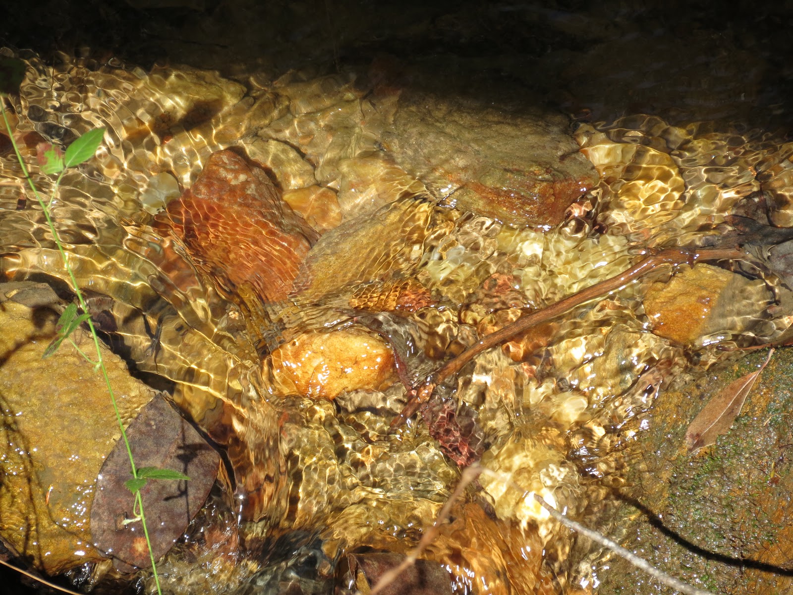
Colors of the river rocks remind us of the high content of copper and other minerals here.
This section of the Ocoee River was "remodeled" to create the white water course for the Olympics in a process that began in 1988.
The course consists of the natural river, augmented by a series of meticulously crafted artificial channels, pools, and rock features. When water is released for recreational purposes today, TVA is reimbursed for lost power gereation via a surcharge on rafting expeditions.
On the way home we drove up to Boyd's Bald, an overlook above the river.
There are more trails up here, but we didn't go far. It was time to get back to work at Carol's.

<iframe width="300" height="300" frameborder="0" scrolling="no" marginheight="0" marginwidth="0" src="https://maps.google.com/maps?f=q&amp;source=s_q&amp;hl=en&amp;geocode=&amp;q=Ocoee+Whitewater+Center,+TN&amp;sll=21.48139,-105.1988&amp;sspn=0.040813,0.06875&amp;t=h&amp;g=21.48139,-105.1988&amp;ie=UTF8&amp;hq=Ocoee+Whitewater+Center,+TN&amp;ll=35.066781,-84.461346&amp;spn=0.010538,0.012875&amp;z=15&amp;iwloc=A&amp;output=embed"></iframe><br /><small><a href="https://maps.google.com/maps?f=q&amp;source=embed&amp;hl=en&amp;geocode=&amp;q=Ocoee+Whitewater+Center,+TN&amp;sll=21.48139,-105.1988&amp;sspn=0.040813,0.06875&amp;t=h&amp;g=21.48139,-105.1988&amp;ie=UTF8&amp;hq=Ocoee+Whitewater+Center,+TN&amp;ll=35.066781,-84.461346&amp;spn=0.010538,0.012875&amp;z=15&amp;iwloc=A" style="color:#0000FF;text-align:left">View Larger Map</a></small>

Monday, April 1, 2013

Tallulah Gorge

Spring came back to Georgia, so I was able to inch my way a little northward.
To Tallulah Gorge State Park...nice campground with great hiking trails.
The trails are well maintained and dog friendly.
Of course there are some other trails that are not so user friendly...
I hiked the North Rim Trail which has several viewpoints of the gorge. This is the Tallulah Falls Dam built in 1913. A series of dams built to provide hydroelectric power were built along the Tallulah River, drastically reducing its flow through the gorge.
The upper gorge is 250 feet in depth from this viewpoint.
The trail near the Interpretive Center is accessible to one of the viewpoints.
The Interpretive Center has many exhibits that highlight the history of the gorge, and a film that takes you on a journey through the gorge without actually hiking it.
Inside the Interpretive Center 
Several movies have been filmed here, including "Deliverance," which is the only title I happened to recognize.
THe most spectacular promotional event in the history of the gorge happened on July 18, 1970 when high-wire artist Karl Wallenda walked across the gorge on a 2-inch thick cable. "I think I want to look down. But I think I better not," said Wallenda during his walk.
His costume. He was 65 years old and this walk celebrated 50 years on the high wire. It took less than 18 minutes, pausing to do two headstands over the gorge.
The 40 foot tower on the North Rim lies on its side along my trail. Wallenda began his walk from this tower. 
The cement pillars supported the tower.
From there he walked the line 1000 feet across the gorge to the South Rim.
 To a shorter 10-foot tower that still stands.
Oceana Falls can be seen from this overlook.
 The gorge is 750 feet deep here.
 There are some side trails I didn't take, since I didn't have a permit to climb or rapell. haha.
 Many vultures were riding the wind in the gorge.
 Ok, there is a higher overlook up there...it's only a quarter mile.
 We'll be careful.
And there are benches strategically placed along the trail.
 We made it. We'll turn around after we look out at Inspiration Point.
Lots of warnings.
 The view looking back toward the Interpretive Center.
You can see the suspension bridge which can be used to access the bottom of the gorge and/or the South Rim. It crosses 80 feet above the water.
 Looking across the gorge at the mountains in the distance.
 Views of the gorge.
Water cascades down this huge cliff into the gorge.
 There are a few stairs to negotiate down and back up.
But not as many as you'd have to climb it you hike to the bottom!
 I decided not to try this one the first day....maybe tomorrow.
I'll just enjoy the view of L'eau d'Or (water of gold) Falls from up here.


On the way back to the campground I stopped to admire the little things.
Like water flowing down narrow streams, racing to the river below.
 Want to watch it with me as we catch our breath and let our heartbeats return to normal? Click on the video.