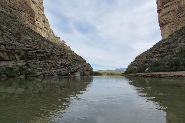
Santa Elena Canyon is on the other side of the park from the campground, and you get there by taking the Ross Maxwell Scenic Drive which highlights geological formations and history. We will pass many interesting rock formations.
There's a short walk to this overlook and a longer trail into the canyon. One of many hikes we did not have time to do on this trip.A view of the ranch from the overlook.
Close-up of the house and corral.
A view down the canyon.
Hoodoo-like rock formations on the mountain.
This formation is called Mules Ears. There's a trail here too we missed.
Had to stop for a wildlife crossing.
Female tarantulas are brown. She doesn't wander far from home.
We stopped to walk to a couple of overlooks here, but skipped the trail down through the canyon.
Tuff Canyon in the foreground. The gap in the distant mesa is Santa Elena Canyon, our destination for today.
Evidence of volcanic activity is evident all around.
Tuff Canyon. There is water in the bottom.
Other views of Tuff Canyon
This rock formation resembles a giant turtle or some prehistoric reptile.
We stopped at the visitor's center in Castleton to inquire about river access and conditions at Santa Elena Canyon. We also had to get a back country permit to paddle up the canyon.
Continuing on we passed remains of other ranching activity.
And passed other trails.
This kayak/canoe ramp is where we thought to put our kayaks in, but the ranger advised doing it at the canyon mouth instead, because it would be a long, difficult paddle upstream from here.
There is an overlook of the canyon before you get to the trail head.
Santa Elena Canyon as seen from the overlook.
The path down to the water seems doable for carrying the kayaks.
And there's a nice put-in area.
Before we thought about kayaking here, we had planned to hike the Canyon Trail. So that's still to do another time. I think we got the better views from the center of the canyon and were able to go beyond where the trail ended.
The kayoo is ready to launch.
I was pleased with the way the kayoo tracked through the current with ease.
Birdie hugged the tree-lined sides. You know she was birding.
Hikers on the trail above.The water looks calm, but the current is running about 5 mph.
Cactus gardens grow on the canyon walls.
Past the green bushes there's a bend in the canyon.
Every time you turn around to look back, you also drift back quite a ways.
And if you stop paddling to rest, you also drift backwards. Birdie said it was an awful lot of paddling to go a little ways up the canyon in her little inflatable.
So I continued on at my own pace.
The limestone cliffs rise 1500 feet above the Rio Grande. Awesome!
Looking back again....I lost Birdie, I think.
There's another bend in the river ahead, but I turned around before I got there. Next time I'll have to devote a whole day to paddling. Too much to see, too little time. And the long drive from the campground means leaving the dog a long time.
When I turned back, the slant of the rocks and the speed of the current created the illusion of going downhill.
Floating downstream. I see Birdie again.
Coming out of the canyon.
River reflections.
More scenery on our return trip.
Sotol Vista gives a 360 degree panoramic view.
The distant mountains are identified.
The view in one direction.
The Sotol Plant this vista is named after. Once used for food, today the baked hearts are fermented and distilled into a tequila-like liquor, also called sotol.
More rock formations.We had time for one short trail.
An oasis of green in the middle of the desert.
Birds are attracted here.
There were two windmills on the ranch. This one still pumps water.
This one is still.
Agave, also known as Century Plant.
The view
Don't tread on me!
A grove of small trees.
The remains of one of the farm buildings.
Bear scat! There is an estimated population of 15-20 Mexican black bears in the park.
The windmill makes a squeaking sound as it turns...the only sound out here,
THe sign warns not to drink the water.
Water being pumped by the windmill.
Ruins of the adobe farmhouse.
A few pieces of wood remain, possibly door or window frames.Another view from the ranch.
Mockingbird.
We pass through one tunnel on the way back to the campground.
And so ends another day.


Loved the pictures. Thanks again.
ReplyDeleteThis was a great day trip! Next time just drive to the put in place!!!
ReplyDeleteIt sounds like a real nice trip. Such wide open vistas.
ReplyDelete